Ha Giang Loop
Published on May 28, 2026
Ha Giang Travel Guide
Meta description: Discover Ha Giang — Vietnam's most dramatic motorcycle frontier, with the Dong Van Karst Plateau, Ma Pi Leng Pass, and remote ethnic minority villages. Guide 2025.
Why Visit Ha Giang
Ha Giang is Vietnam's northernmost province and its least-traveled frontier. The Dong Van Karst Plateau — a UNESCO Global Geopark — occupies the province's far north, a high-altitude landscape of eroded limestone mountains, deep river gorges, and tiny villages perched on ledges at 1,500–2,000 meters. The Ha Giang Loop, a 350-km motorcycle circuit through the plateau, has become one of Southeast Asia's defining adventure rides, attracting travelers who have already done the rest of Vietnam and want something harder and more remote.
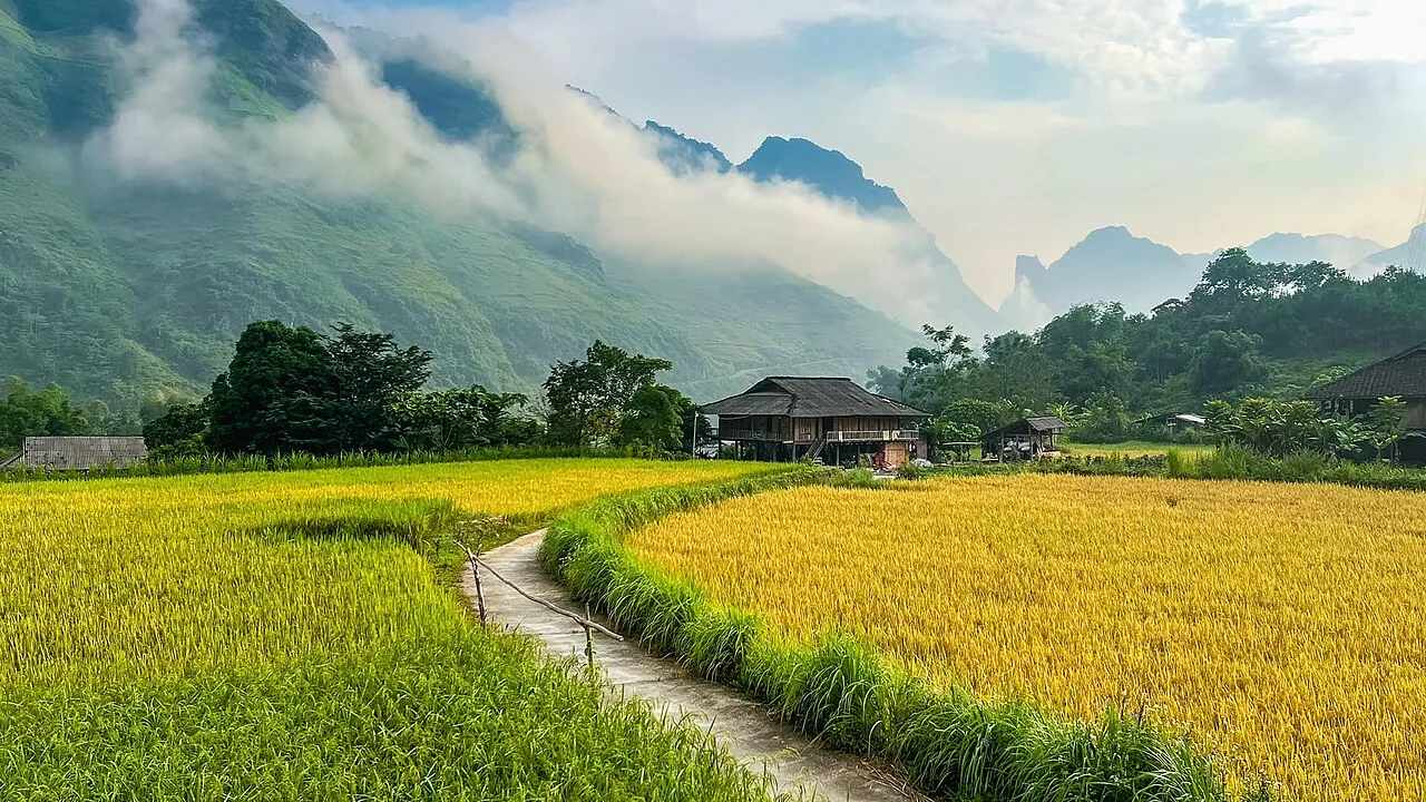
What makes Ha Giang unlike any other destination in Vietnam is its combination of geological extremity and cultural density. The province is home to over 20 ethnic minority groups — Hmong, Tay, Dao, Lo Lo, Pu Peo, and others — many of whom live essentially as they have for centuries, in villages accessible only by mountain track. The Sunday markets at Dong Van and Meo Vac are not staged for tourism; they are genuine weekly gatherings where communities trade goods and socialize across the plateau's distances.
The infrastructure is basic. The roads are demanding. The rewards — for the right traveler — are among the most significant in Vietnam.
Quick Facts
- Location: Ha Giang Province, far northern Vietnam, 320 km from Hanoi
- Best time to visit: October–November (buckwheat flowers, clear skies) or March–April (flowering season)
- Recommended stay: 4–7 days for the full loop
- Daily budget: Budget $20–35 | Mid-range $40–70 | Luxury options limited
- Permit required: Foreign travelers need a special permit to visit Dong Van District (issued in Ha Giang City, free of charge, same day)
Top Things to Do in Ha Giang
1. The Ha Giang Loop (Dong Van Karst Plateau Circuit)
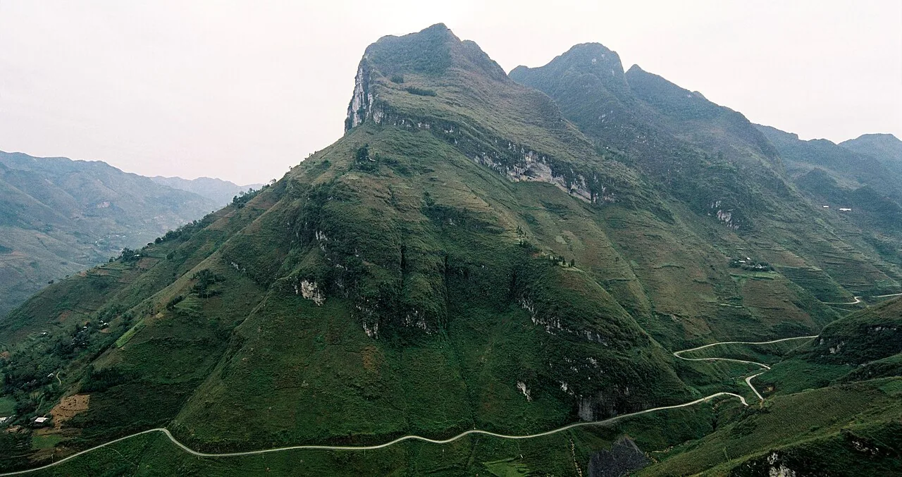
The defining Ha Giang experience — a 350-km motorcycle circuit from Ha Giang City through Quan Ba, Yen Minh, Dong Van, Meo Vac, and back via Du Gia and Bac Me. The route passes through four-season mountain scenery, crosses six significant mountain passes, and reaches Dong Van — Vietnam's northernmost district town — before returning via the Ma Pi Leng Pass above the Nho Que River. Duration: 3–5 days depending on pace. Tip: Rent a semi-automatic motorbike ($8–12/day) in Ha Giang City if confident; hire an Easy Rider guide ($25–35/day including bike, guide expertise, and local introductions) for the most rewarding experience.
2. Ma Pi Leng Pass
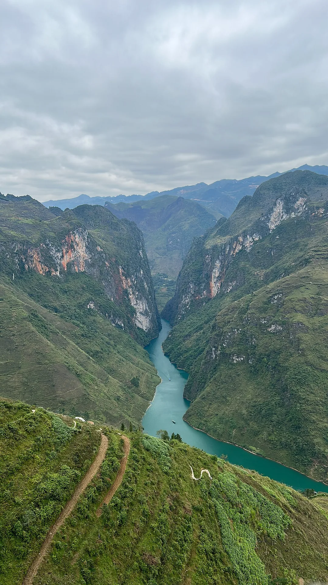
The most spectacular section of the Ha Giang Loop — a 20-km mountain road cut into the face of the Ma Pi Leng cliff above the Nho Que River gorge, 900 meters below. The pass took 16 months to complete using hand tools, completed in 1965. The viewpoints along the road look down into a canyon of startling depth, with the emerald Nho Que winding between sheer limestone walls. Duration: 1–2 hours to drive and stop at viewpoints. Tip: Stop at every viewpoint; the light and cloud conditions change constantly. Morning light (before 10am) illuminates the canyon walls most dramatically.
3. Dong Van Old Quarter
The Dong Van town market area and old quarter contain a collection of French colonial and Chinese merchant buildings — some dating to the early 20th century — preserved by remoteness rather than deliberate policy. The Sunday market draws Hmong, Lo Lo, and Pu Peo traders from villages across the plateau. The old quarter's Pho Bang village, 4 km away, is in even better condition. Duration: 2–3 hours. Tip: Arrive Saturday evening to see the market preparations; the main trading activity is Sunday morning 7–10am.
4. Heaven's Gate (Cong Troi) at Quan Ba
The first dramatic viewpoint encountered on the loop — two symmetrical hills rising from the Quan Ba Valley floor, known as the Twin Fairy Mountains, framed by terraced fields. The road crests the pass at 1,500 meters with panoramic views north into the karst interior. Duration: 30 minutes to stop and photograph. Tip: Often cloud-obscured in the early morning; approaching from Ha Giang City in the late morning gives better odds of a clear view.
5. Buckwheat Flower Fields (October–November)
Each October and November, the abandoned fields across the Dong Van Plateau bloom with buckwheat — pink and white flowers covering the rocky karst ground that otherwise supports little agriculture. The combination of limestone mountain, flowering field, and traditional Hmong villages creates a landscape unlike anything else in Vietnam. Duration: Throughout the loop. Tip: The most concentrated buckwheat landscapes are around Lung Cu and along the approach to Dong Van town.
6. Lung Cu Flag Tower — Vietnam's Northernmost Point
A 33-meter tower on the summit of Lung Cung Mountain marks Vietnam's geographic northernmost point, bearing the national flag at 1,468 meters. The tower is visible from the surrounding plateau; the climb (286 stone steps) reaches a viewpoint that looks north into China's Yunnan Province. The surrounding Lung Cu village is home to Lo Lo ethnic minority communities. Duration: 1.5 hours including drive from Dong Van. Tip: Combine with a walk through Lung Cu village to see traditional Lo Lo architecture.
7. Meo Vac Sunday Market
The weekly market at Meo Vac, 23 km from Dong Van by road over the Ma Pi Leng Pass, is considered by many travelers to be the most authentic ethnic minority market in Vietnam. Hmong, Flower Hmong, and Dao women in full traditional dress gather to trade livestock, produce, and hand-crafted goods. The cattle market in a separate enclosure adds a sensory intensity missing from more tourist-oriented markets. Duration: 3–4 hours. Tip: The market begins at dawn (6am) and winds down by 11am; arrive early for the best activity.
8. Nho Que River by Boat
From the base of the Ma Pi Leng gorge, boat trips navigate the emerald Nho Que River through the canyon — looking up at the cliff face and road 900 meters above. The perspective from the water is as dramatic as the view from the pass. Duration: 1.5–2 hours. Tip: Boats depart from a small dock near the Sung La valley at the canyon's base; accessible by a switchback road from the main highway.
9. Du Gia Village and Waterfall
The return leg of the loop often passes through Du Gia — a scenic valley with a significant waterfall, ethnic Tay villages, and opportunities to interact with communities less visited than those on the plateau's main circuit. A brief hike leads to the base of the falls. Duration: 2 hours including stop. Tip: Du Gia makes a pleasant overnight stop with basic homestay options; it breaks the return journey from Meo Vac to Ha Giang City into manageable distances.
10. Homestay with Hmong Families
Several villages on the plateau — including Lung Cam, Pho Bang, and Sung La — have established homestay programs with H'Mong families. Staying overnight in a traditional Hmong house, sharing a meal cooked over a wood fire, and waking to the morning light on the karst mountains is the kind of travel experience that motivates the entire journey. Duration: 1–2 nights. Cost: 150,000–250,000 VND per person including dinner and breakfast. Tip: Arrange through your Easy Rider guide or directly with guesthouses in Ha Giang City.
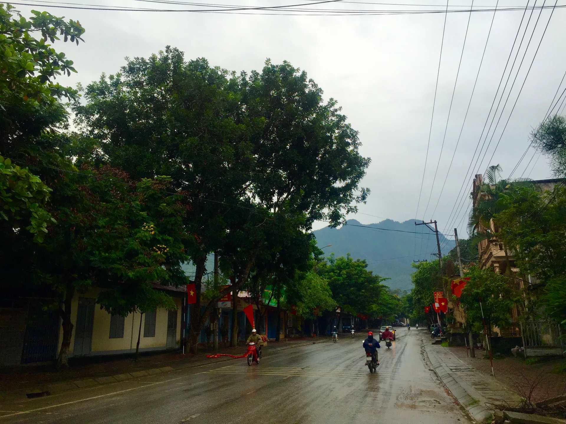
Ha Giang — Vietnam's northernmost province is also its most dramatic; the rocky plateau (cao nguyen da) is a landscape of limestone pinnacles, gorges and H'Mong villages
Local Food and Specialties
Thang Co: The Hmong stew made from horse or buffalo meat — also found in Sapa but most authentic on the Dong Van Plateau where it has been prepared by the same communities for generations. Found at market stalls on Sunday market days.
Men Men (Corn Porridge): Ground corn cooked into a stiff porridge — the staple food of Hmong communities on the karst plateau where rice cannot grow and corn is the primary crop. Often served alongside meat stews or fermented vegetables.
Ha Giang Orange Wine: Hoang Su Phi District, the western part of Ha Giang Province, produces a wild orange variety used to make a local fruit wine. Sweet, lightly fermented, and distinctive.
Smoked Pork (Lon Cam): The Hmong tradition of smoking pork over wood fires produces a strongly flavored cured meat that travels well and keeps through the highland winter. Sold at markets across the plateau.
Com Lam (Bamboo Rice): Glutinous rice steamed in bamboo — found throughout northern highland Vietnam but ubiquitous on the Ha Giang Loop as a roadside lunch option.
Best Time to Visit Ha Giang
October–November: The most celebrated season — buckwheat flowers bloom across the plateau in shades of pink and white, and the harvest has turned the rice terraces gold. The weather is often clear and cool (15–22°C). The most popular months for the loop; expect more travelers.
March–April: The second peak. Plum and peach blossoms on the slopes; terraces being prepared for planting; clear skies after the winter fog season. Temperatures 18–25°C.
December–February: Cold (5–10°C on the plateau, frost possible at altitude), occasionally foggy and drizzly. The Hmong New Year celebrations (usually December–January) take place in villages across the plateau and are extraordinary to witness if you can coincide. Not recommended without proper cold-weather gear.
May–September: Warm, occasionally rainy. The plateau's summer green is beautiful but road conditions deteriorate after heavy rain, and landslides can temporarily close sections of the loop. Avoid after sustained rain.
Where to Stay in Ha Giang
Ha Giang City (base): Canary Hotel, Ha Giang Backpacker Hostel, and 85 Travel Hostel are all well-positioned for morning permit collection and loop departure. Prices are low: $8–20/night.
On the loop:
- Quan Ba: Basic guesthouses; the town is small. OK Hostel Quan Ba is clean and friendly.
- Yen Minh: Small town with acceptable guesthouses. Hoang Ngoc Hotel is the most commonly used.
- Dong Van: Lao Xa Homestay in the old quarter and Ha Giang Loop Hostel both have atmosphere and basic comfort.
- Meo Vac: Very basic options; most loop riders push on or back to Dong Van for the night.
Homestays: The most memorable accommodation on the loop. Ask your guide to arrange in advance.
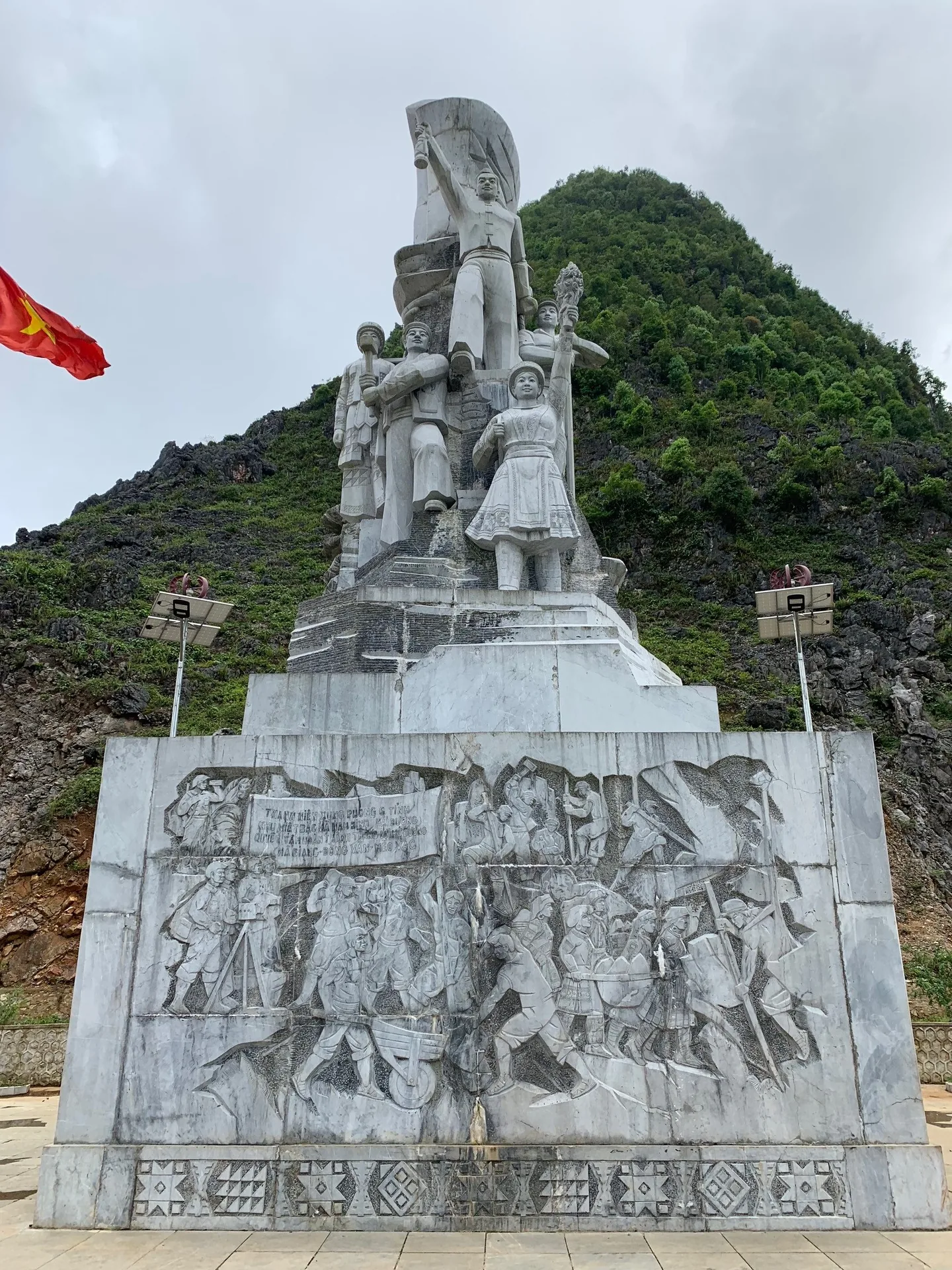
H'Mong communities of Ha Giang — the Flower H'Mong wear the most elaborate embroidered costumes in Vietnam; Sunday markets at Dong Van and Meo Vac draw traders from across the plateau
How to Get to Ha Giang
By bus from Hanoi: Multiple daily departures from My Dinh and Gia Lam stations to Ha Giang City — 6–7 hours on express buses, 8–9 hours on standard services (150,000–200,000 VND). Night buses allow departure after work with arrival at dawn.
By car from Hanoi: 5–6 hours via the Hanoi–Lao Cai expressway and Highway 2. Private car hire costs 1,500,000–2,000,000 VND.
By motorbike from Hanoi: A 2-day ride through Tuyen Quang or along Highway 2 directly. Recommended as part of a longer northern loop for experienced riders.
Note: Ha Giang has no domestic airport. Hanoi is the only practical gateway.
Suggested Itineraries
3 Days (Shortened Loop)
Day 1: Ha Giang City to Dong Van via Quan Ba Heaven's Gate and Yen Minh. Day 2: Dong Van old quarter and Sunday market (time departure accordingly), Lung Cu flag tower. Day 3: Dong Van to Ha Giang City via Ma Pi Leng Pass and Meo Vac.
5 Days (Full Loop with Detours)
Days 1–3 as above but at a slower pace with overnight in Quan Ba and full Dong Van exploration. Day 4: Meo Vac, Nho Que River boat trip, overnight Du Gia. Day 5: Du Gia to Ha Giang City via Bac Me.
7 Days (Extended Exploration)
Full loop with additional days in Dong Van for village walks, market days, and plateau hikes. Includes Sung La valley and Lung Cam homestay.
Local Culture and History
Ha Giang's ethnic minority population represents over 20 distinct groups, many of whom migrated to the plateau from southern China over the past three to five centuries under pressure from the expanding Qing Dynasty. The Black Hmong, White Hmong, and Flower Hmong sub-groups each maintain distinct dress, dialect, and ceremonial traditions. The Lo Lo and Pu Peo communities of the far north are among Vietnam's smallest ethnic minorities — some with fewer than 3,000 members total.
The Dong Van Karst Plateau UNESCO Global Geopark designation (2010) recognized the geological significance of a landscape that preserves 500 million years of geological history in its limestone layers — the oldest and most complete record of Paleozoic ocean floor in Southeast Asia.
The French colonial presence in the plateau was limited to small administrative outposts and the remarkable road infrastructure — including the Ma Pi Leng road — built with corvee labor. Chinese merchant families established trading posts in Dong Van's old quarter in the early 20th century; their descendants still operate some of the buildings.
Travel Tips
- Permit: Required for all foreigners visiting Dong Van District. Obtainable free from the Ha Giang Tourism Department on arrival (bring passport). Most guesthouses assist with the process.
- Riding ability: The Ha Giang Loop involves mountain roads with sharp bends, exposed edges, and variable surfaces. Do not attempt it on a motorbike without prior experience. Hiring an Easy Rider guide is strongly recommended for inexperienced riders.
- Fuel: Petrol stations are infrequent on the plateau. Fill up whenever you see one. Carry a small reserve if possible.
- Weather changes: Conditions on the plateau change rapidly. Carry rain gear regardless of forecast.
- Responsible tourism: Many communities on the plateau receive increasing tourist numbers. Ask before photographing people; purchase directly from artisans at markets; avoid bargaining aggressively for handmade goods.
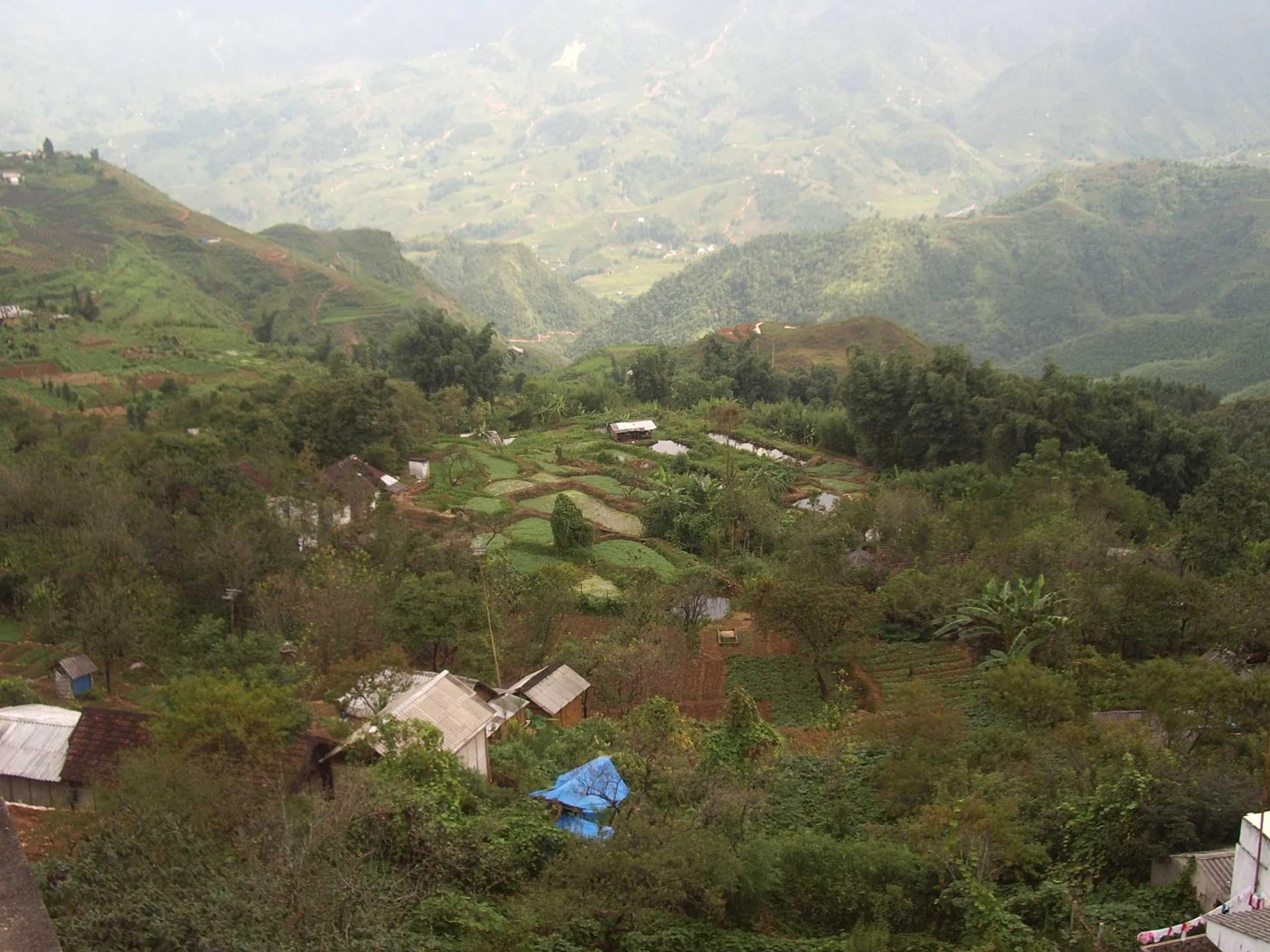
The Ha Giang loop terrain — the 350km circuit typically takes 3-4 days; Ma Pi Leng Pass above the Nho Que River gorge is the most photographed section
Frequently Asked Questions
Do I need riding experience for the Ha Giang Loop? Yes. The roads are challenging even for experienced riders. At minimum, you should be comfortable on a manual or semi-automatic motorbike on mountain roads before attempting the loop independently.
What does an Easy Rider guide cost? Approximately $25–35 per day, including the guide's motorbike and their expertise as interpreter, navigator, and cultural intermediary. This is excellent value.
Is Ha Giang suitable for female solo travelers? Yes — many solo female travelers do the loop each year. The Easy Rider guide system provides both safety and companionship. Exercise standard caution regarding alcohol consumption at homestays.
Can I rent an automatic scooter for the loop? Not recommended — automatic scooters lack the engine braking needed for steep descents and the power for some climbs. Hire a semi-automatic (110cc manual) at minimum.
How many km is the full Ha Giang Loop? Approximately 350 km for the standard circuit. Detours to Lung Cu and side valleys add 50–100 km.
Final Thoughts
Ha Giang demands something from you — riding ability, physical tolerance for cold and rough roads, genuine curiosity about the communities you pass through. In return it offers landscape and cultural encounter of a quality that is genuinely diminishing in the world. The buckwheat plateau in October, the market at Meo Vac at dawn, the Nho Que canyon from the Ma Pi Leng road — these are experiences that stay with travelers for the rest of their lives. Go before it changes.
Keywords: Ha Giang travel guide, Ha Giang Loop, Ma Pi Leng Pass, Dong Van Karst Plateau, things to do in Ha Giang, best time to visit Ha Giang, Ha Giang motorbike tour